All week, I’ve had the idea of hiking Pike’s Peak in the back of my mind. I have already hiked one mountain on this trip (Buck Mountain), so why not make it two? That’s a great idea!
I knew this would be a serious hike though. It is a thirteen mile hike up Barr Trail to the top of Pike’s Peak and a thirteen mile hike back. That’s three miles less than what I did at Buck Mountain, but I would be gaining seventy-three hundred feet of elevation instead of thirty-five hundred. It would also be colder; the air would be forty degrees instead of sixty-five.
So last night, I made sure that everything was in order. Lou generously lent me a Camelbak so that I would have a real hiking backpack instead of the bulky school backpack I lugged up Buck Mountain. He also lent me a set of two-layer gloves. The black outside layer had special fingerpads so that I could use my phone while wearing them. The white inside layer had silver in the weave to help retain heat.
Into the Camelbak, I stuffed Cliff Bars, trail mix, a bagelwich, sunglasses, an extra shirt, and the gloves. I used the straps on the bottom to hold my windbreaker.
I set all of this out last night (except the bagelwich, which I left in the fridge) and went to bed early so I’d be rested up for the big hike. I wanted to get going as early as possible. I’d found free parking in Manitou Springs several miles away from the trailhead. A shuttle goes between the parking and the trailhead once every twenty minutes from 6:00 A.M. to 8:00 P.M. I wanted to get on the first shuttle of the day so I’d have plenty of time to finish my hike and be back before the last shuttle left.
I slept peacefully, knowing that the preparation and planning were taken care of. All I had to do this morning was wake up and go. There turned out to be a slight problem with that though; I slept an hour past the alarm I set for 5:00 A.M. Oops! I jumped out of bed, picked up my pack, grabbed my bagelwich from the fridge, and rushed out the front door. I made it to Manitou Springs by 6:40 A.M., in time to catch the third shuttle. Not a perfect start to the day, but not a complete failure either. There would still be thirteen hours for me to finish the hike.
I had five fellow hikers for company on the shuttle. One was a middle-aged man, here for his annual hike up the mountain. He had a ticket for the COG rail so that he wouldn’t have to hike back down. The other four were together – two guy friends and their girlfriends. They hoped to make it up and back today like I did.
I stepped onto Barr trail at 7:02 A.M., after a short walk from the shuttle stop. The trail started out tough – two miles of switchbacks and semi-steep climbing. My sleepy brain wondered if I really wanted to do this thing. Yes, I did.
The gloves Lou let me borrow were a lifesaver. I hiked for five minutes without them and my hands started to feel like swollen pincushions. I pulled the gloves out of my backpack and put them on. My hands felt a little better immediately and after several minutes they were perfectly normal.
The hike up was long, and not as scenic as Buck mountain had been. Green trees and brown rocks are nice (I suppose), but after staring at them for a few hours, they became extremely boring. I started to wish for a change. The landscape must have heard my wish. I passed the treeline and all the green disappeared so that I was left I was left with brown all around. Be careful what you wish for…
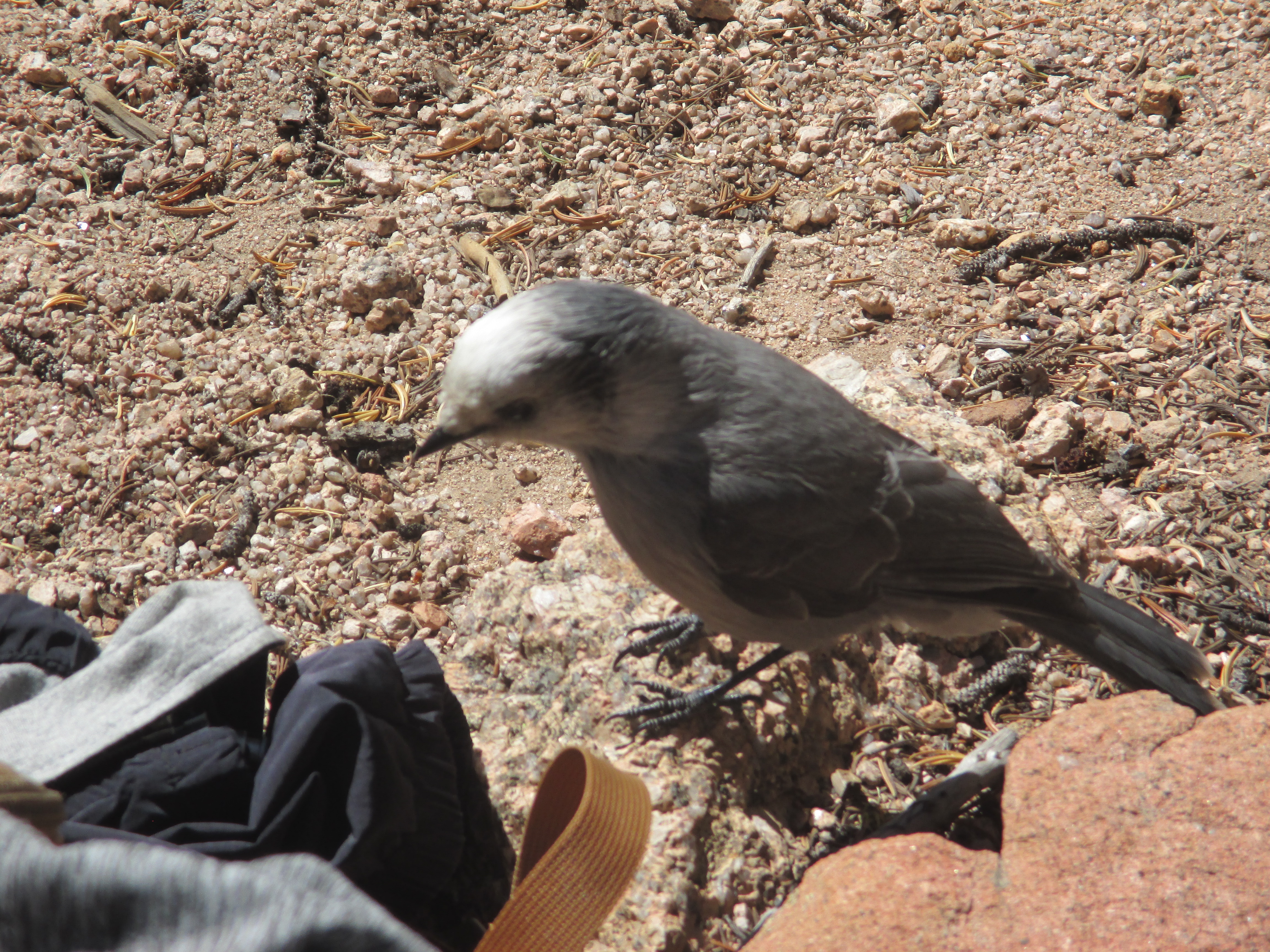
With four miles to go, I stopped for a bagelwich lunch. Several birds joined me. One of them seemed especially interested in me. I held out a little piece of bagel and the bird hopped up onto my leg, flew away, then came back and snatched the bread out of my fingers.
As my journey continued, another creature joined me. I wasn’t sure what it was – it looked like a beaver and a squirrel put together.
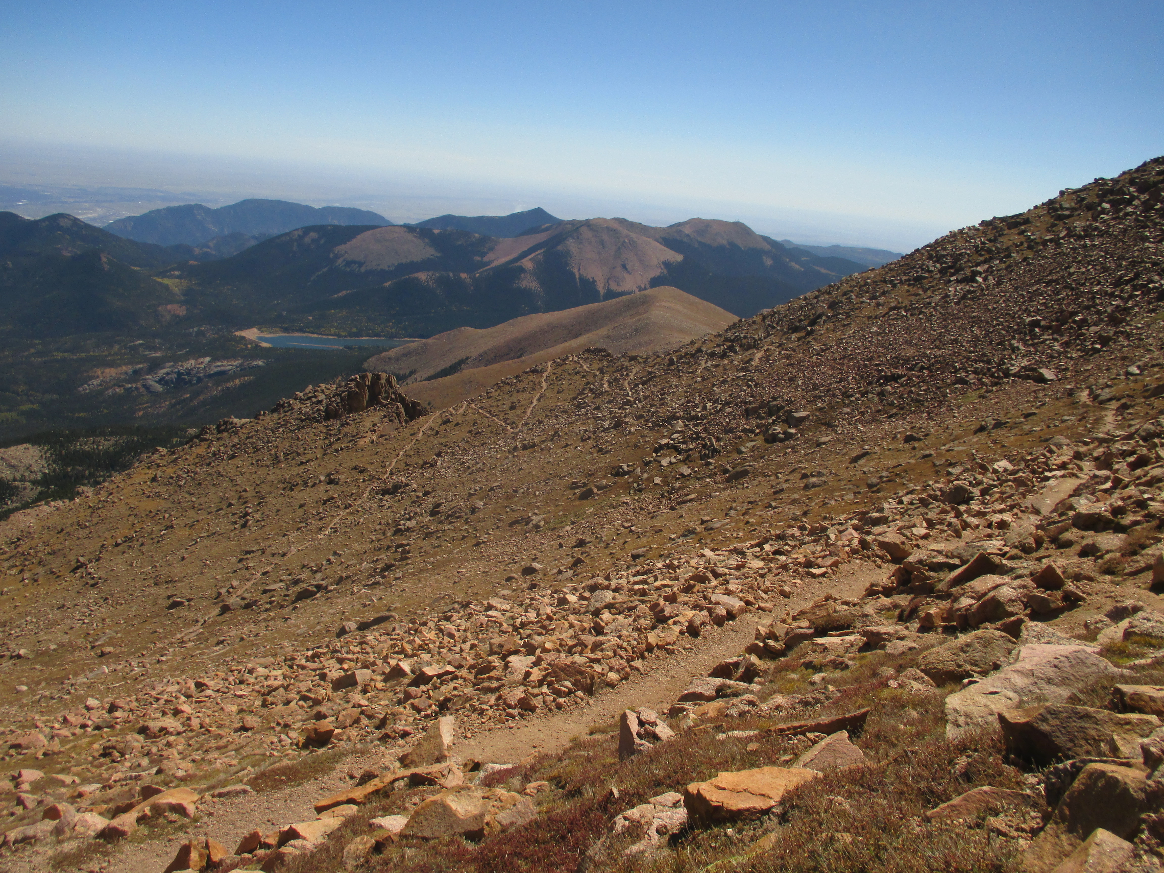
At about twelve thousand feet, the view improved dramatically. I was high enough to see all around, and I found that brown rocks really can be picturesque with the proper background. I passed a hiker who was on his way down and we took pictures of each other.
At one point, I looked back over the last bit of the trail I had followed. From where I stood, it was faintly visible on the mountainside as a sweeping curve headed toward the far ridge, a series of switchbacks zig-zagging down that ridge, and a long straight line moving away from the ridge again.
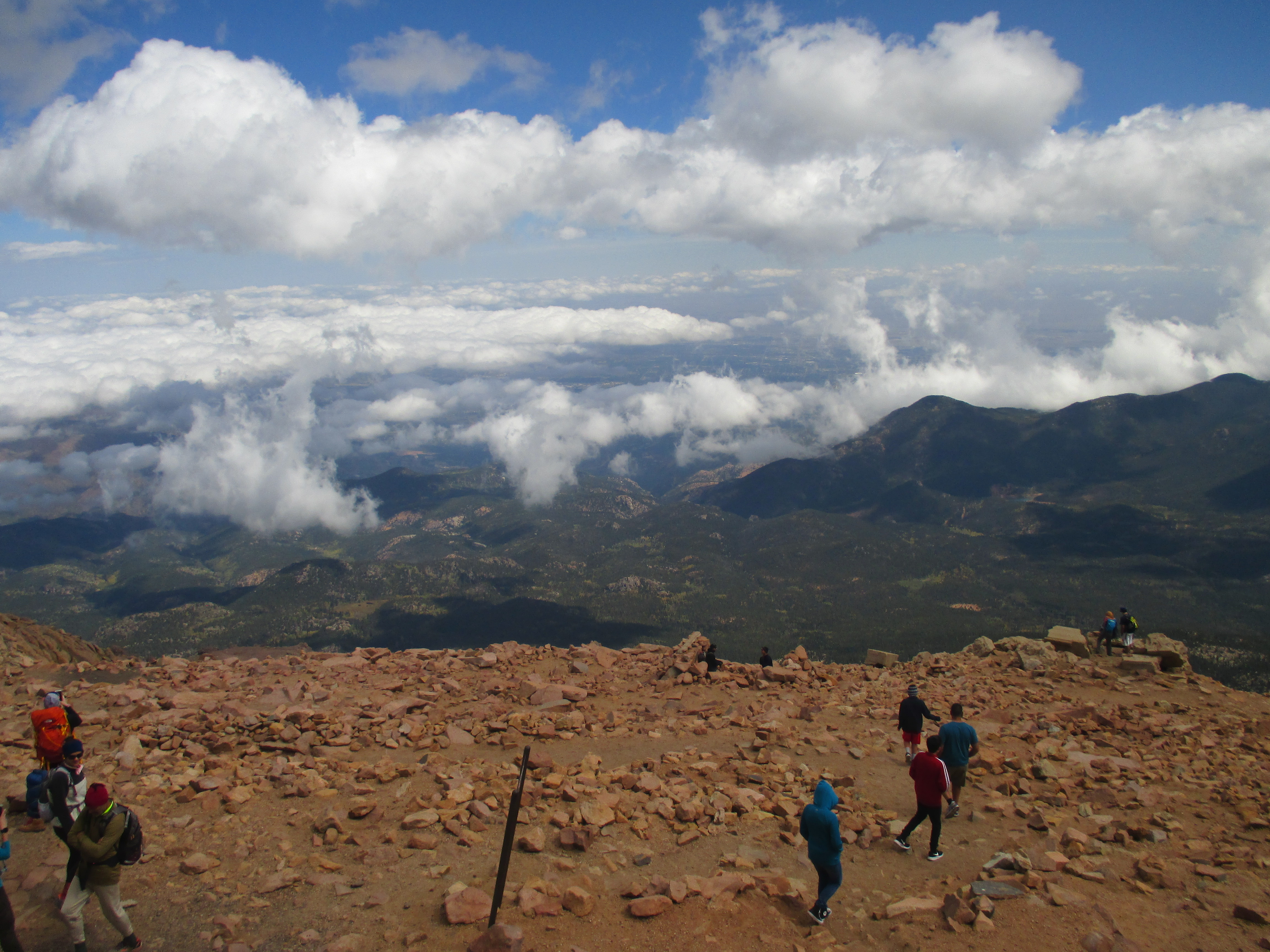
The last two miles stretched on interminably. I stepped off the trail at 1:02 P.M., exactly six hours after I started the hike. As I reached the top, I was glad to just be done. In the big picture, I was only halfway done; I still had to go down. But I didn’t let myself think about that. I let myself enjoy the feeling of being done and of surviving.
I walked through the doors of the Summit House and saw, to my relief, that there were two water fountains waiting just for me. I still had water in my Camelbak, but I was trying to drink it sparingly. At the water fountains, I could drink as much as I wanted. Except for one tiny problem. They didn’t work. Argh! Who puts water fountains at the end of a thirteen-mile trail without any water in them? Cruel people, that’s who. People who laugh at the suffering of parched hikers like me!
So much for quenching my thirst. I decided to just drink a little more from my Camelbak, buy a hot chocolate, sit down, and eat some of the trail mix I’d brought with me.
A few minutes after I sat down, a middle-aged man walked by my table. He had a Nikkon camera with him and he looked familiar. Suddenly, I remembered why.
“Hi sir!” I said. “We were at the Molly Kathleen mine together yesterday!”
“Oh yeah!” He replied. “What a coincidence! It’s good to see you again. Did you hike up the mountain?”
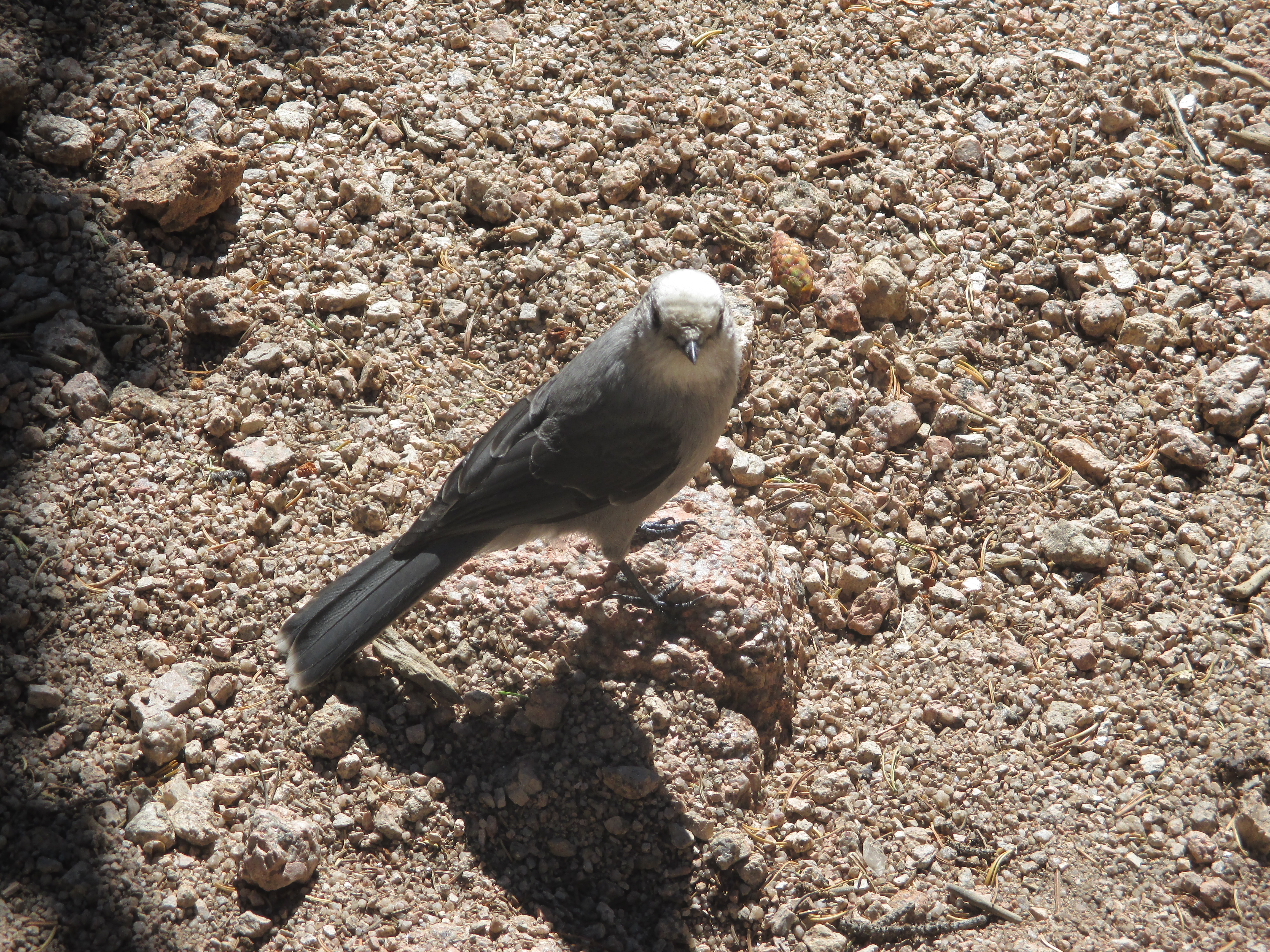
I told him that I had indeed hiked up the mountain, and we chatted for a couple minutes. He told me that he took the COG rail and was there with two friends. As we talked, I showed him a few pictures I had taken. Finally, I came to the mystery animal that I had seen; the beaver-squirrel.
“Hey, I saw this animal on the trail today. Do you know what it is?”
“Sure, that’s a marmot.”
Instantly, my mind flashed back to the scene where I met this man yesterday and I started to laugh at myself.
Yesterday, Marie took us to the Visitor’s Center at the Molly Kathleen mine, where we learned that the mine itself was closed. It was here that I met the man. I was standing in front of an exhibit that showed animals commonly seen in the Rocky Mountains. There were pictures of eight animals. I was able to identify seven of the eight, but the last one gave me trouble.
I wondered aloud, “What is that last animal?”
A man behind me spoke up. “That’s a marmot.”
I turned around to see a middle-aged man carrying a Nikkon camera.
I said, “Thanks!” and walked to the next exhibit.
I talked with the man at a couple other exhibits in the Visitor’s Center and, at the time, forgot all about that first conversation – until today, when I asked the very same man the very same question. Thankfully, while we were talking today he did not seem to remember that particular conversation from yesterday.
After this man left to get back on the COG rail and go down the mountain, I wasn’t quite ready to resume my hike. I stayed in my seat and looked for more people to talk with. I ended up meeting a real, live knight and dame! Their names were Bill and Eileen, and they were part of the Order of Malta – the oldest surviving chivalric order (begun in the eleventh century), whose motto is, “Defence of the Catholic Faith and assistance to the poor.” Bill is a retired Air Force pilot. We chatted until they had to catch their ride down the mountain.
Now that two groups had left in the time that I was sitting, I decided that I should get moving too. I made sure everything was stuffed back into my pack, put on my gloves, and walked out the back door of the Summit House.
Before I got back onto Barr Trail, I was arrested by a thought. Wouldn’t it be cool to do pushups fourteen thousand feet above sea level? I decided to find out.
After doing twenty-five, I came to the conclusion that pushups feel exactly the same at sea level as they are on top a mountain. But I had gotten a start on the two hundred pushups I had scheduled for the day, so it was a good experiment.
I stepped back onto Barr Trail at 2:02 P.M., which meant I had a little less than six hours to make it down before the last shuttle departed. And I did make it. I stopped at several places to do the remaining hundred seventy-five pushups over the next three hours, and had a mostly unremarkable hike down the rest of the way. I did see an F-16 fly quite close overhead. And I narrowly escaped being run over by mountain bikers who were zipping down the trail. And managed to get lost for twenty minutes. But my mind was focused on getting down and finding somewhere to sit down, so I barely noticed those things. Finally, I finished. I walked off the trail at 7:01 P.M., eleven hours and fifty-nine minutes after I started.
I got to the shuttle stop before 7:20 P.M. and called home while I waited for it to arrive. The shuttle dropped me off at my car, I drove back to The Mansion and freshened up, and then I went out with Lou and Valli to enjoy a wonderful Mongolian Barbeque dinner. When we returned to The Mansion, I went straight to bed and enjoyed a glorious night’s sleep.
Louis and I planned to drive up Pike’s Peak this morning, so we were excused from helping with the yard work. I suppose we abused our freedom though because we spent the morning sleeping in rather than driving. Finally, a little before noon, we got into the car and started on our way.
We enjoyed a beautiful drive to the base of the peak. The leaves have just started changing on some of the trees around here, so the sun makes the hillsides glow green with streaks of bright yellow cutting through.
At the bottom of the peak is a toll booth. I knew we would have to pay to get in, and I figured that the fifteen dollar vehicle admission fee was better than the forty-four dollar fee to ride the railway up the mountain.
At the top, Louis and I put on our heavy winter coats before getting out to explore. The wind whipped right through my coat as if it weren’t even there. My car said that the temperature was only forty-two degrees, but the wind made it feel at least ten degrees colder.
Eventually, the air got too cold for me and we went back to the car, ready to begin the descent. And then we changed our minds and got back out. There was one store at the top, called the Summit House, and we wanted to check it out. We found that most things were expensive (of course), but we were hungry. We passed up the seven dollar chicken sandwiches for one dollar “world famous” donuts and three dollar cappuccinos.
After enjoying these goodies, we began our descent for real. Well, we did still have one more stop to make. Marie told us we should take a walk on the Elk Park Trail which is about a mile down the road from the top of the mountain. We had looked for it on the way up but didn’t see it. Her description hadn’t done much to get me excited about finding the place. She said, “You’ll see a white marker sticking up out of the ground slightly to the left of the road. Drive straight toward that marker until you drive off the edge of the mountain. Once you’re over the edge, you’ll see that there’s actually a dirt road under your tires, and you won’t fall thirteen thousand feet to the ground.”
Those were her directions for approaching the trail from below. Finding it from above turned out to be very easy and much less terrifying. As I drove around a bend in the mountain, I saw the dirt road connect to the main road that I was driving on, and I just had to do a quick U-turn to get onto it.
A few hundred feet down the road, we saw the trailhead and found a place to park. Louis and I got out and followed the trail for about three-quarters of a mile. I didn’t notice that the path sloped downhill until we started back uphill to return to the car. It was just a short walk, but by the time I made it back to the top, I was winded. Maybe it was the thin air, or maybe I need to start exercising again!
We made it back to The Mansion around 3:30 P.M. Louis had to be back at the airport at 5 P.M. tonight for his flight back to Brea, so we went out for an early dinner at Culver’s. I’d driven past a couple of these fast-food restaurants so far during my stay in Colorado. Their advertisements highlight their “frozen custard” and “butterburgers.” I tried a butterburger. It was good but tasted just like any other decent hamburger to me. I still want to try their frozen custard though.
After dinner, we made it to the airport on time and dropped Louis off at his terminal. Lou, Valli, and I went back to The Mansion and concluded the night with two games of Sequence (a board game where you place tokens on the board based on the cards in your hand and attempt to be the first player to make a row of five tokens), and two games of Cribbage (a card game in which you gain points from various combinations of the cards in your hand, and try to be the first player to a hundred-twenty points).
Tomorrow is Sunday, so we won’t be working in the morning. I won’t sleep in quite as late as I did today though.
THE GRAND HIKING PLAN
– Bring a lot of food and water
– Take some pictures
– Listen to an audiobook
– Walk a long, long way
This was my strategy as I woke up and drove back to the Teton National Forest this morning. I suppose it would be more accurate to call it an outline. A very rough outline. Looking back, it probably could have been improved if I had figured out specific details (especially about where I was walking). But if I took the time to work all of that out, maybe I would have chickened out and not gone on the hike. And then I would have missed my favorite adventure of this trip so far. Here’s the story of how it turned out.
I did bring a lot of food. Two ham and cheese bagelwiches, two cliff bars, two servings of protein powder, one snack-sized bag of trail mix, half a bag of baby carrots, and five bottles of water. Yes, I put all of that in my backpack. It was heavy and made me sweat disgustingly (although that may have happened even if I hadn’t been wearing the backpack). It was well worth it all though when I was able to satisfy my hunger and thirst with the treasures I carried.
I took some pictures. Quite a few pictures – over a hundred, for the second day in a row. Yesterday it was easy to sort through the photos. Some were interesting and most weren’t. The interesting ones went into my post for the day and the others will be forgotten. Today it’s harder. The mountains, trees, animals, and clouds were incredible from every angle. A hundred pictures are too many to post though, so I picked my favorite-favorites and had to leave the rest (my just-normal-favorites) behind on my SD card.
I listened to an audiobook. I borrowed A Connecticut Yankee in King Arthur’s Court by Mark Twain from the online library I use. I started it on my drive to the trailhead and finished it about three-quarters of the way through my hike. Eventually, I’ll write my thoughts about it on the “Books” page that is linked on the sidebar of this site. There’s already more than enough to write about today without adding in a book summary.
I did walk a long, long way – and I did a lot more climbing than I expected to. Last night, I decided to start my hike at the Taggart Lake Trailhead and see how far I could go. It looked like the trail went in a big circle around the Teton Range. I thought it would be cool to see the mountains from the every angle, and that’s what I expected to do. It turned out that the trail goes over the top of the mountains, not around, and that the full loop is at least a forty-mile trip. By the time I figured that out, I was already over six miles into the hike and I really didn’t want to turn back. I decided to keep going until prudence absolutely insisted that I turn back. Before I talk about that though, I should probably go back to the beginning.
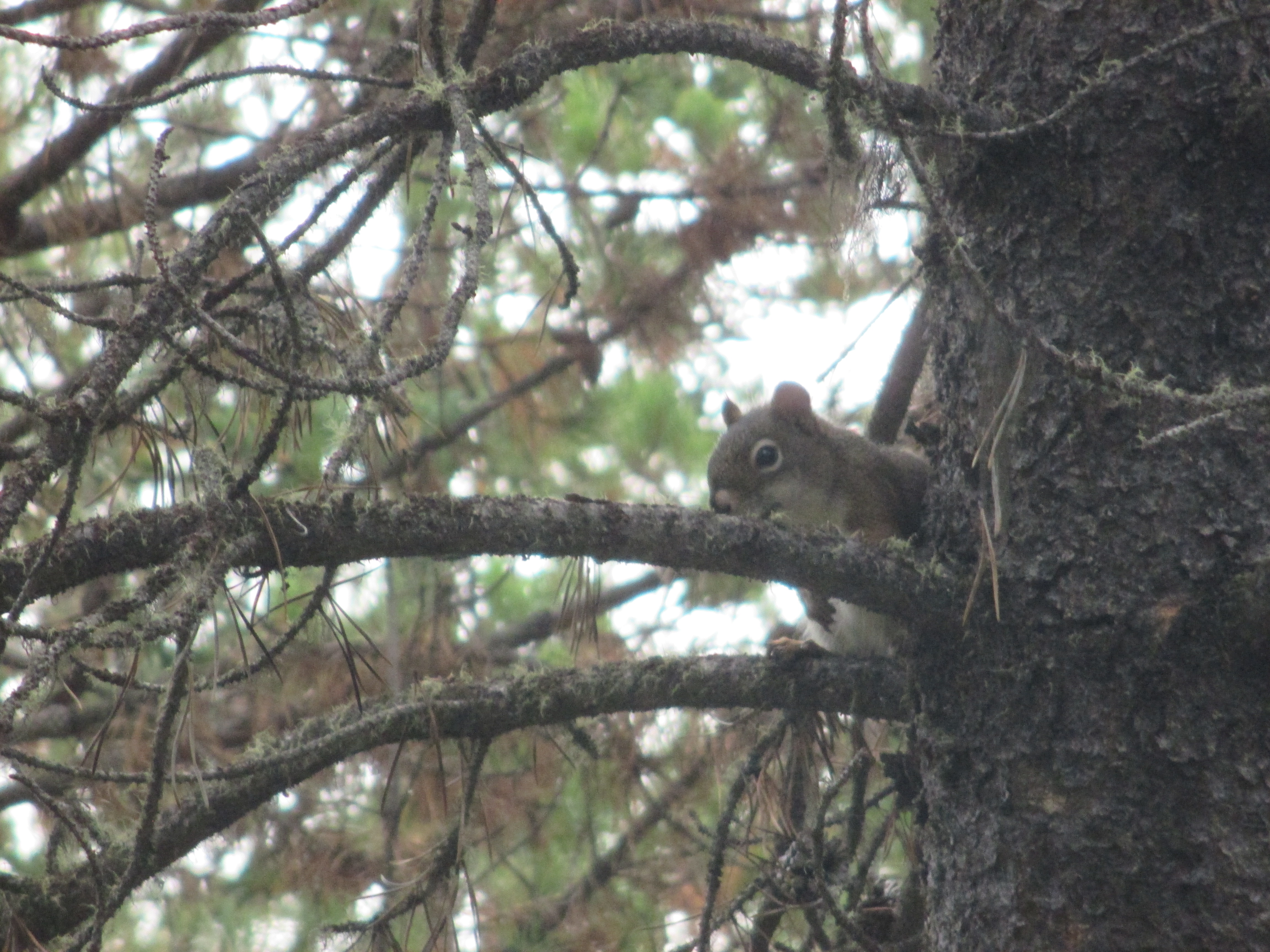
The hike started out well. After walking for a solitary forty-five minutes, I met a friendly squirrel – at least I think he was a squirrel. Maybe Sam, the official wildlife expert on this site, can double check that for me. Anyway, the squirrel (as I will call him for now) seemed quite excited to see me with my camera and he posed perfectly for a picture. I think he was embarrassed after I took it though because he started to hide his face behind the branch he was sitting on.
The path was well kept for the most part. There were a few places though where I had to push my way through fresh undergrowth that hadn’t yet been trimmed back.
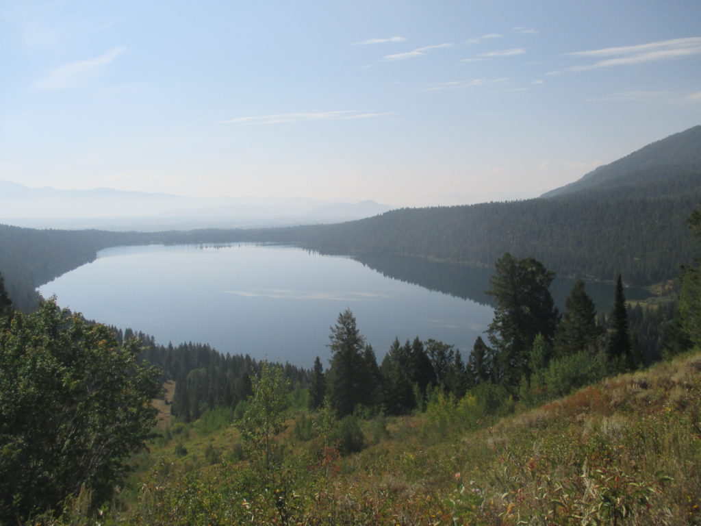
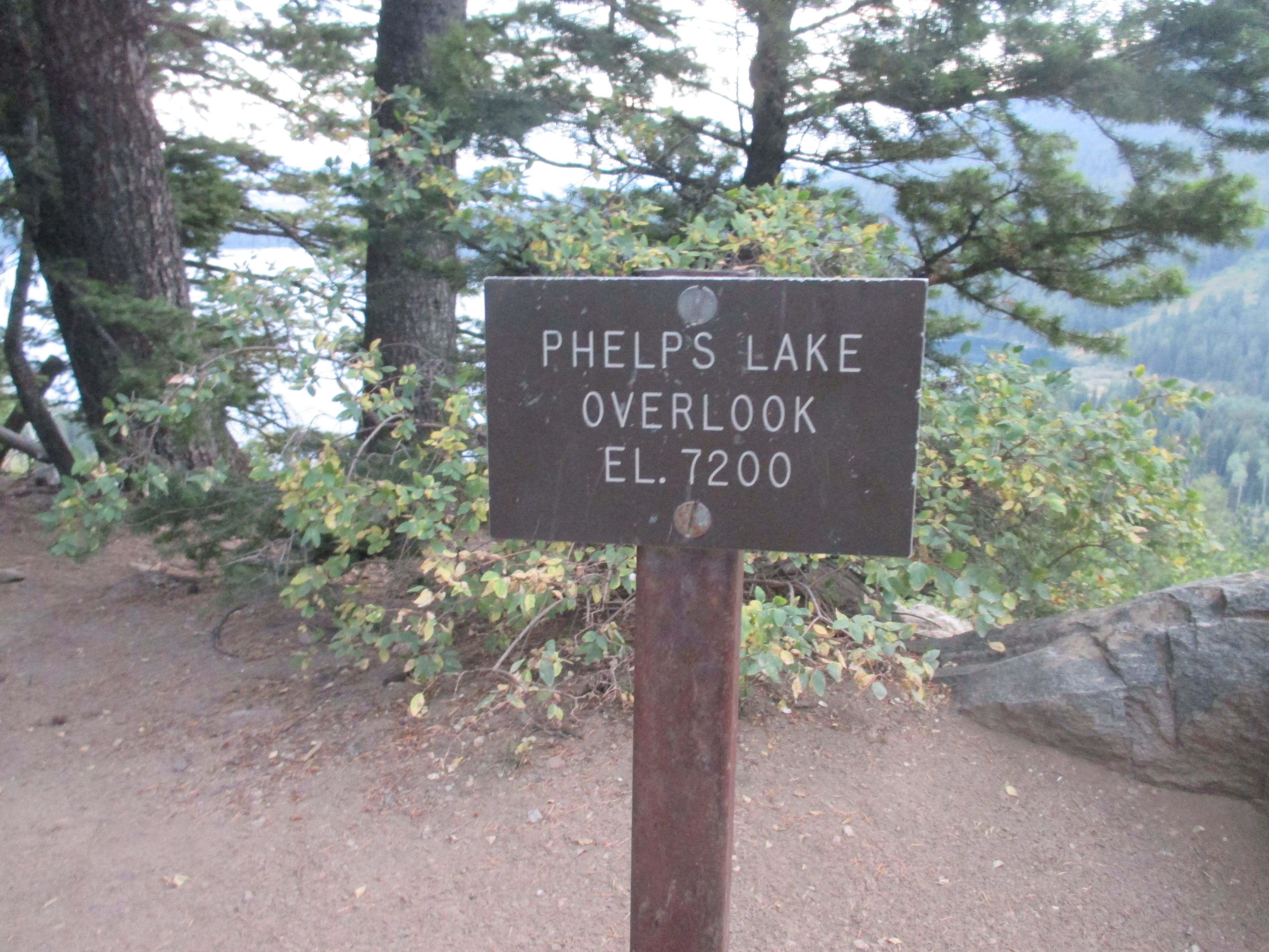
The grass and vegetation stayed with me for the first three miles. Then I was moved onto a hardpacked dirt path which led in a long, gradual slope to this view of Phelps Lake. From here the trail went into downhill switchbacks. I enjoyed the easy walk down and I hoped I wouldn’t have to walk back up.
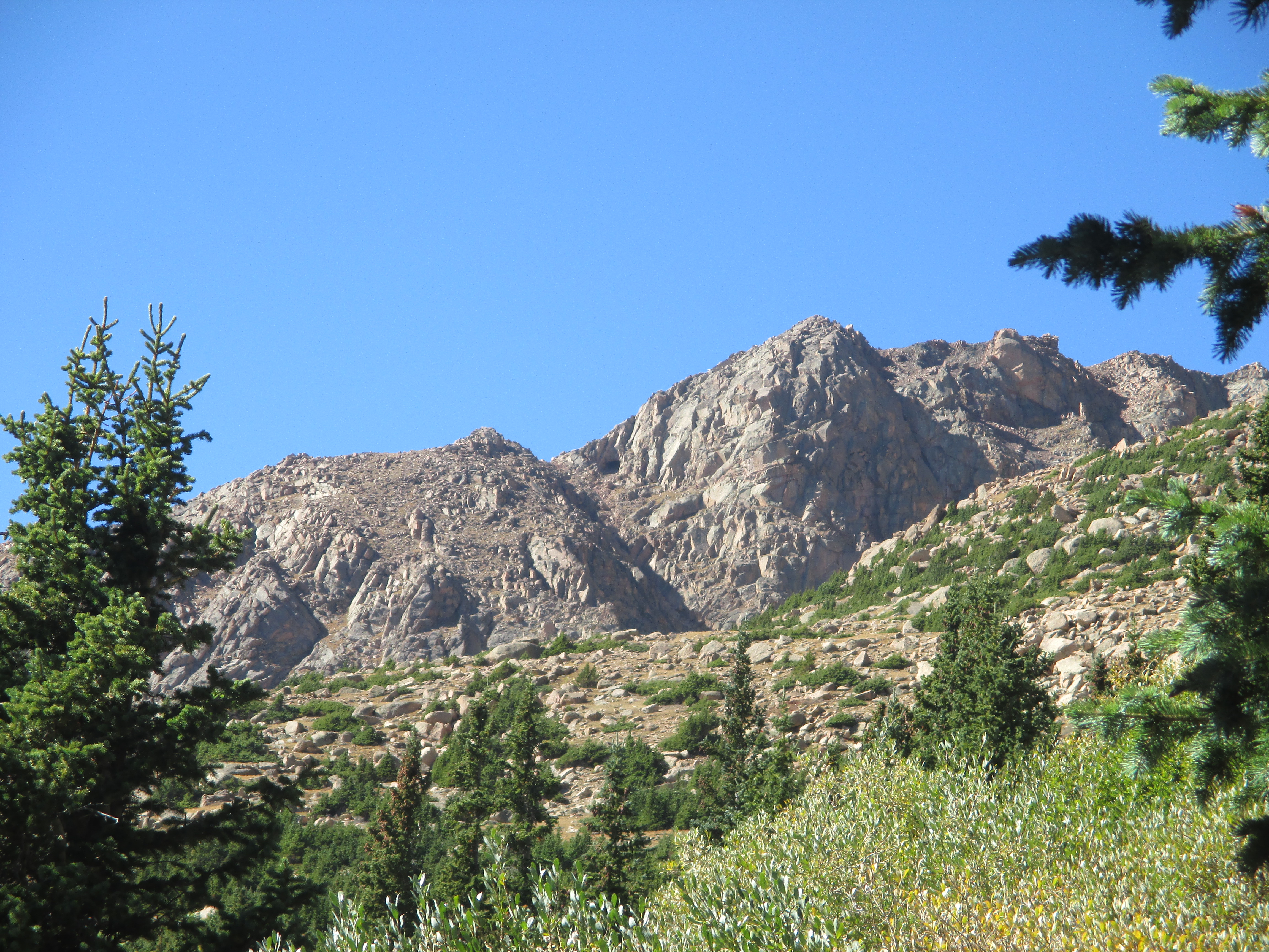
The hardpacked dirt continued and I started to ascend again. I got a great side view of the mountain range.
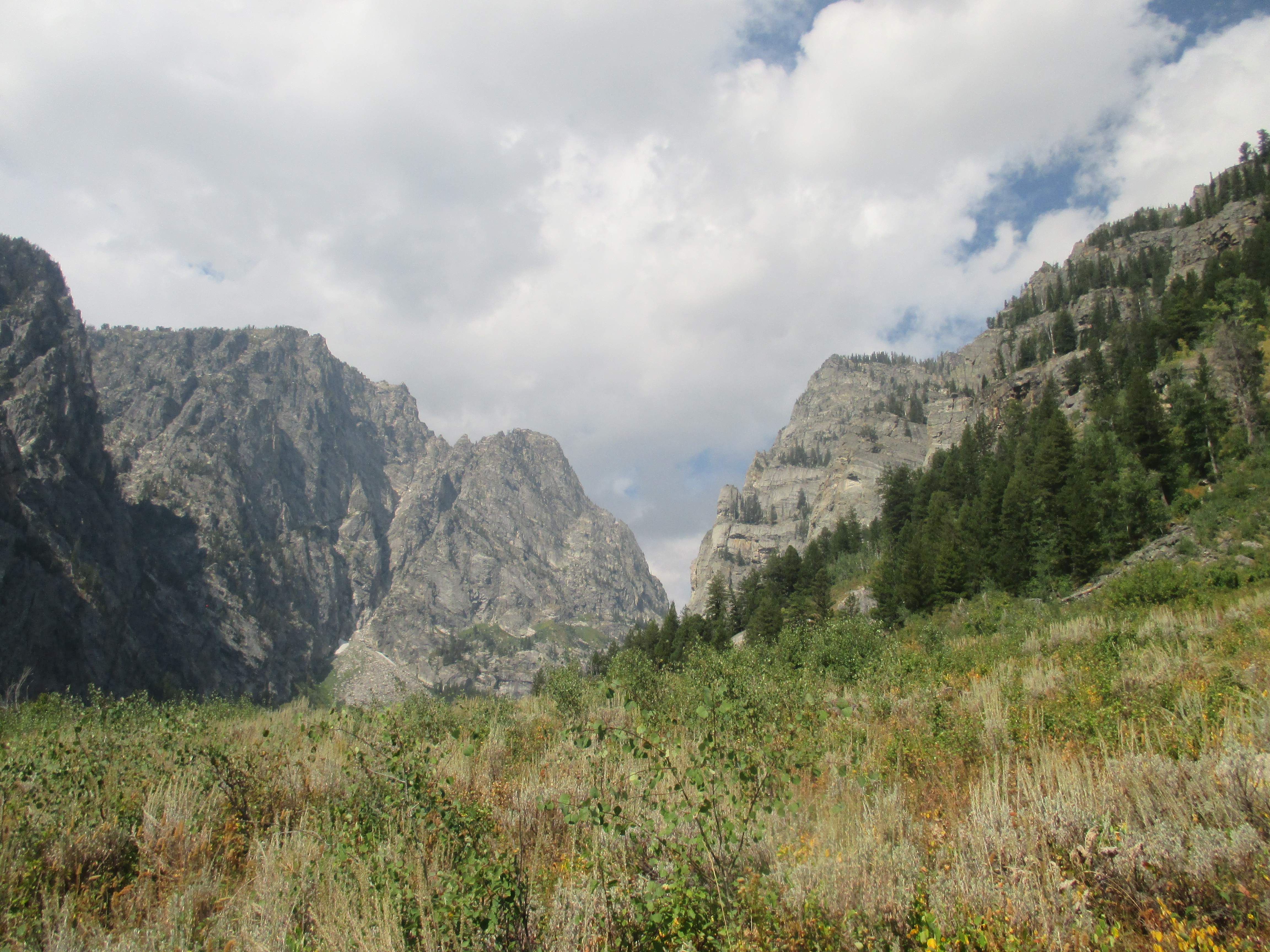
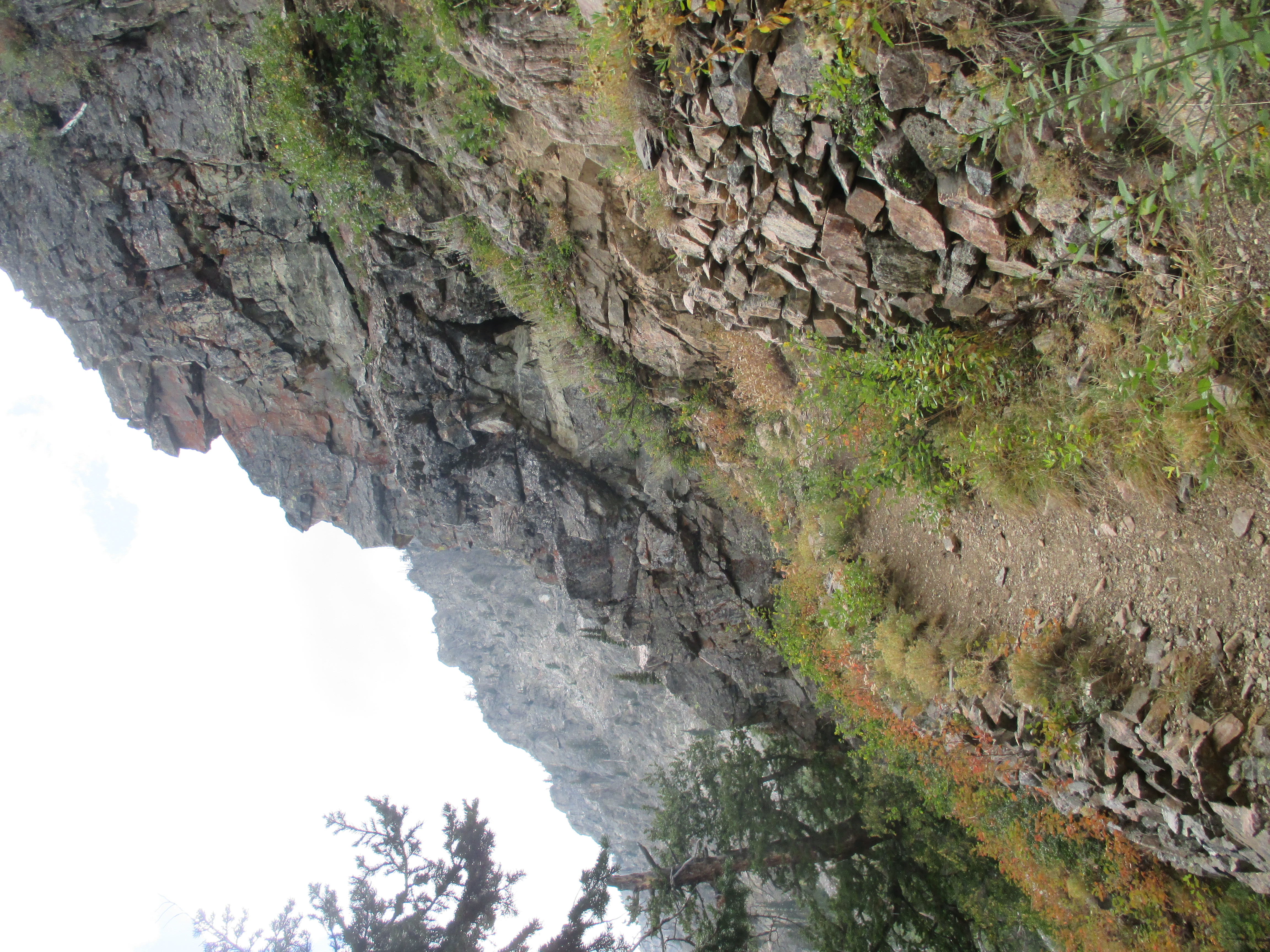
At this point, I started to figure out that I was headed right toward the middle of the mountains, not the back. The trail began to climb more steeply and stones appeared in the pathway, sometimes as steps and sometimes only managing to get in the way. A series of tiny waterfalls ran roughly parallel to the trail and sometimes came close enough for me to walk onto them.
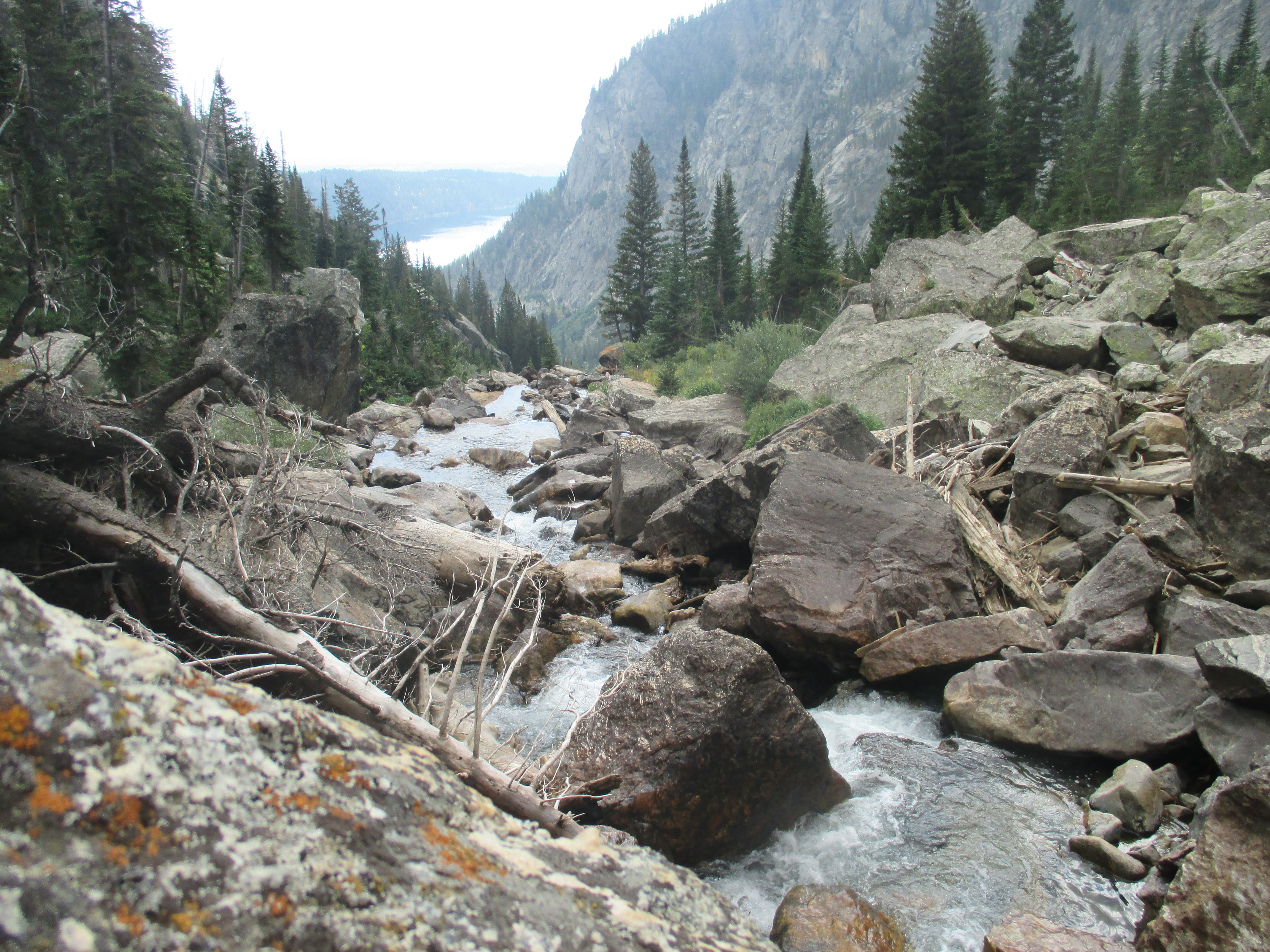
Eventually the I reached a clear pool of water that fed the waterfalls. Once I passed that, I entered a dense forest that ushered me to the base of what turned out to be a four-mile path of endless switchbacks. This was by far the worst part of the hike. So far, I had gone about ten miles in a little over three hours. This four-mile stretch took another three hours all by itself.
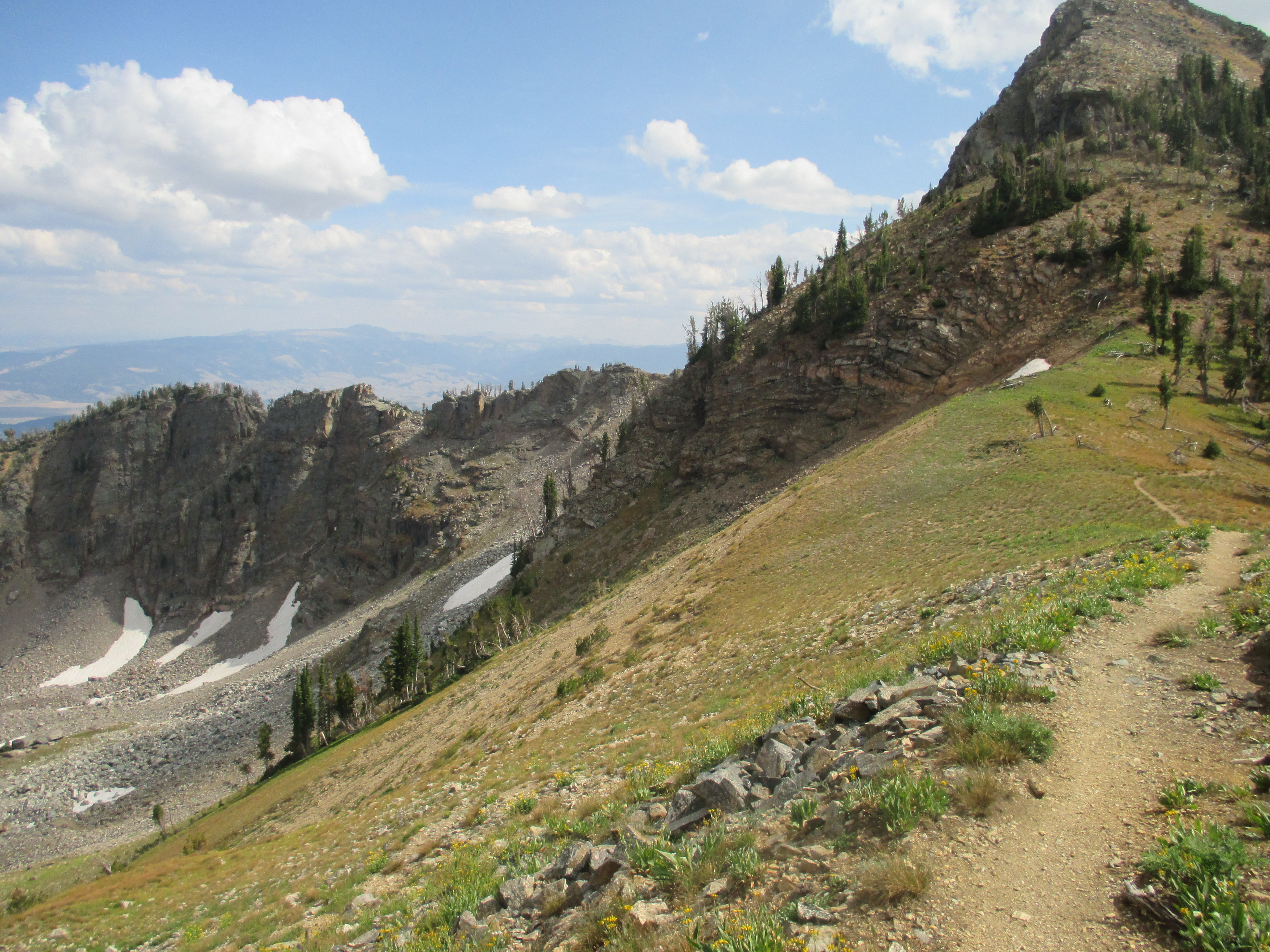
In the picture on the left, you can see the narrow path that led upward. If you look carefully at the picture on the right, you’ll see the flowers and grass in the foreground with everything else in the background. The only thing in between was a steep slope with some shrubbery growing on it. I didn’t think that falling off the side of the path would be very fun so I did my best to avoid it.
Those switchbacks seemed to last forever. I did my best to keep moving up, then I’d rest for a few minutes. I felt wimpy when I needed to rest every hundred steps, but I knew I was still making progress. At last, I made it. Not to the top, but to a ridge that was almost flat. I looked behind me and saw this beautiful view.
I kept going up, but I knew it was getting too late in the day for me to even hope that I could finish the loop. I knew that it would be beyond stupid to try. I would most likely get stuck on the peak of a mountain all night in thirty-degree weather and then I’d be discovered by a mother bear who would think I was a popsicle and carry me away to her den where she would share me with her hungry cubs.
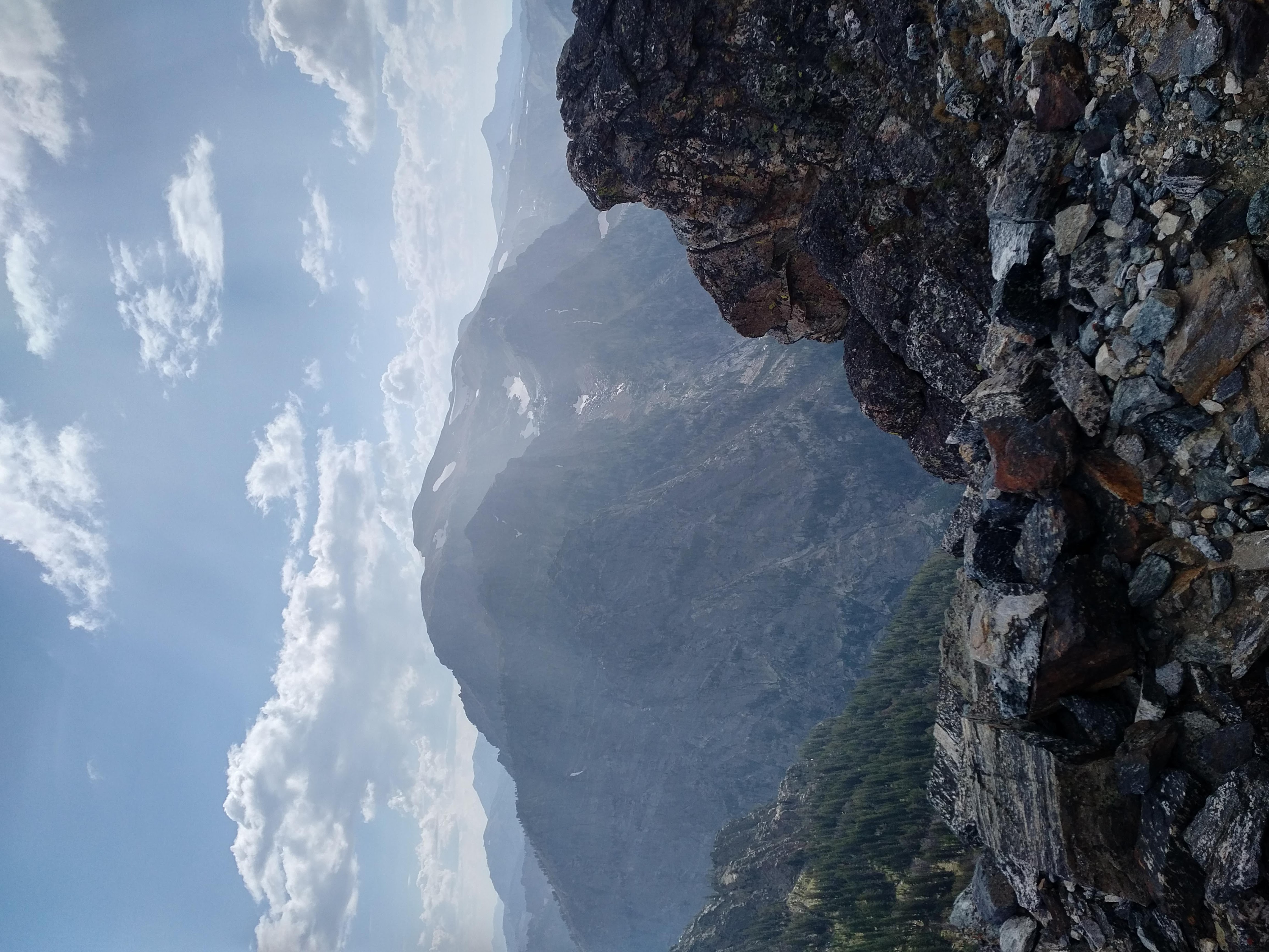
Before giving in and taking the wise course back down the mountain, I went a little further up the trail to see what I would miss when I turned around. I saw the peak of Buck Mountain, about a thousand feet higher up. I climbed toward it until the switchbacks started again. Then I took a couple more pictures of the heavenly mountain panorama I had walked so far to see and started back down the mountain.
The trip down didn’t seem too long at first. The switchbacks only took an hour and a half to get through. And on my way down, I was cheered on by another friendly rodent. This looks like a chipmunk to me, but I’ll need to call on Sam again before I know for sure.
The reality of this hike set in on me as I made my way back through the forest and down the rocky steps next to the waterfalls. Getting to the top of the mountain had been difficult. But now I had to go back and retrace every step I had taken. It was much easier going down, but by this point, I had walked twenty miles already today.
I told myself that when I arrived back at Phelps Lake, I would take a break and enjoy the last bagelwich that I had been saving to eat sometime during the return trip. I made it back to the lake and happily stretched out on the rocks and roots shown in the picture below and to the left. I had a clear view of the lake from here, similar to the picture I took as I passed Phelps lake on my way up the mountain.
From my cozy perch, I watched the sun make its way toward the horizon. I didn’t want to be stuck out in the dark forest alone, so I got back on my tired legs and continued my return trip.
To take my mind off of my tired legs, I decided to knock out the two hundred pushups I still needed to do in Wyoming. I stopped every ten minutes over the next several miles, to do a set of twenty pushups, then got up and started walking again.
The sun went down while I was still walking and when it eventually got dark, I used my phone’s flashlight to make sure I stayed on the path. Soon after dark, I reached the Taggart Lake Trailhead. I still had to walk a quarter mile to the parking lot, and I managed to finish off the long walk with my new trademarked move – wandering around in circles while trying to figure out which way to go.
I did eventually get myself pointed the right way and made it safely to my car around 9:30 PM. I climbed stiffly into my car and checked my watch to see how many miles I had put on my feet today. It showed twenty-nine point seven miles. I really wished that I could have hit thirty, but my legs wanted nothing to do with me after what I had already put them through.
I drove back to my campsite and walked around in circles some more as I got myself ready for bed. When I lay down in my sleeping bag, my watch told me I hit exactly thirty miles for the day. That was a great way to go to sleep.
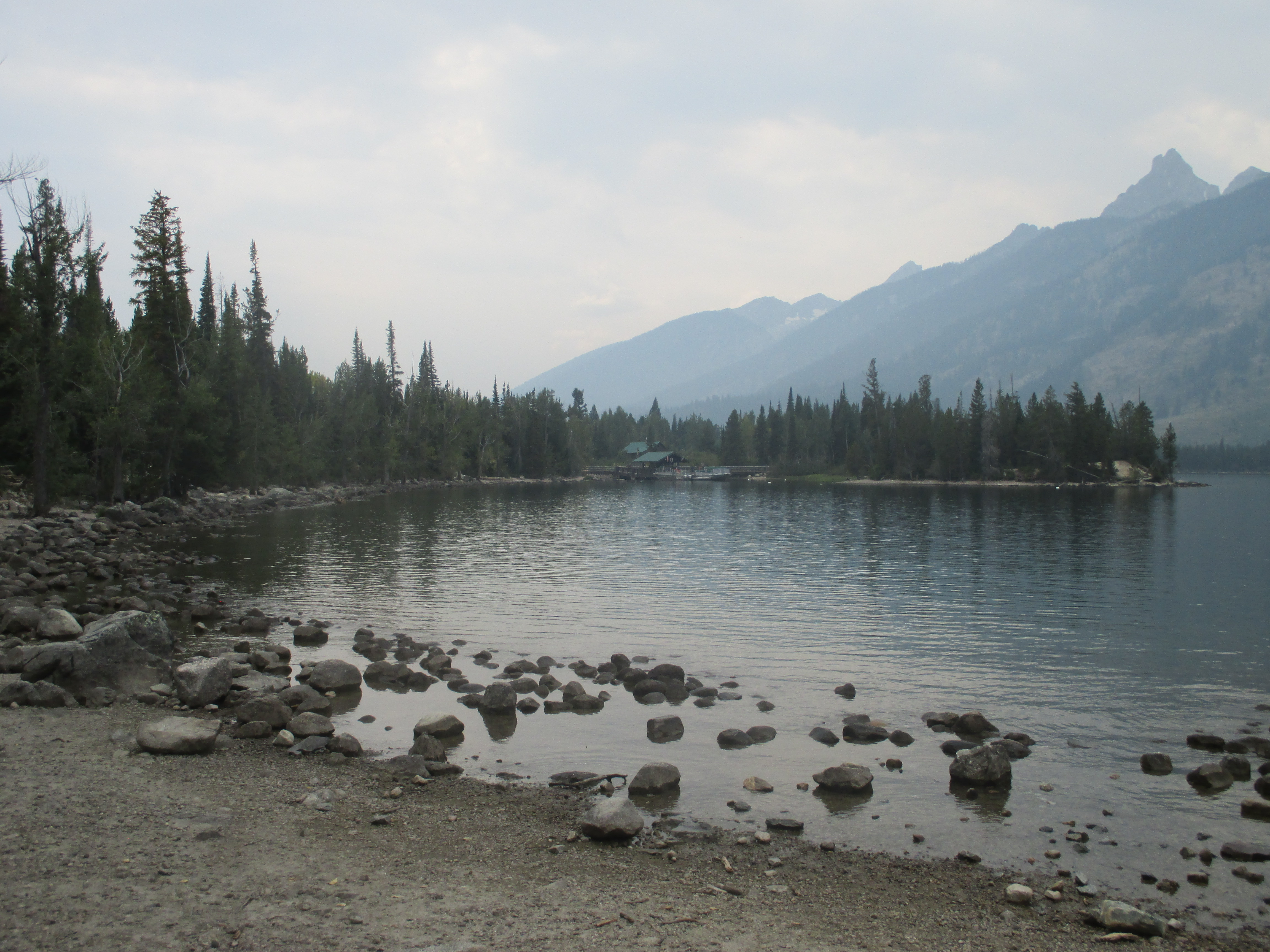
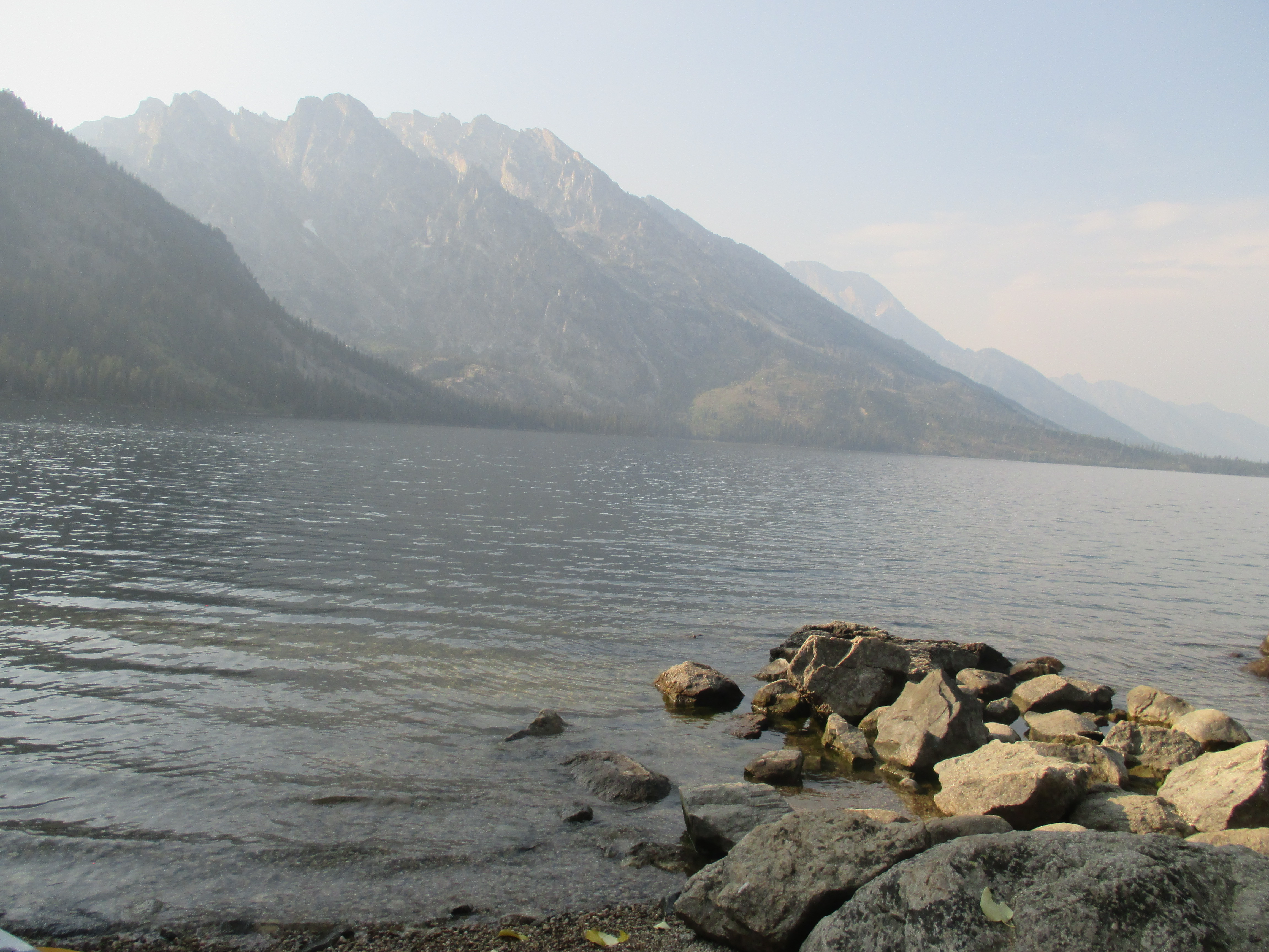
This was a simple day. I woke up intending to go on a “writing hike.” I was going to explore some trails at Jenny Lake (the largest of several small lakes in the area) and take several breaks along the way to write. I ended up with a relaxed morning, a late start, and a long hike with only a little writing included.
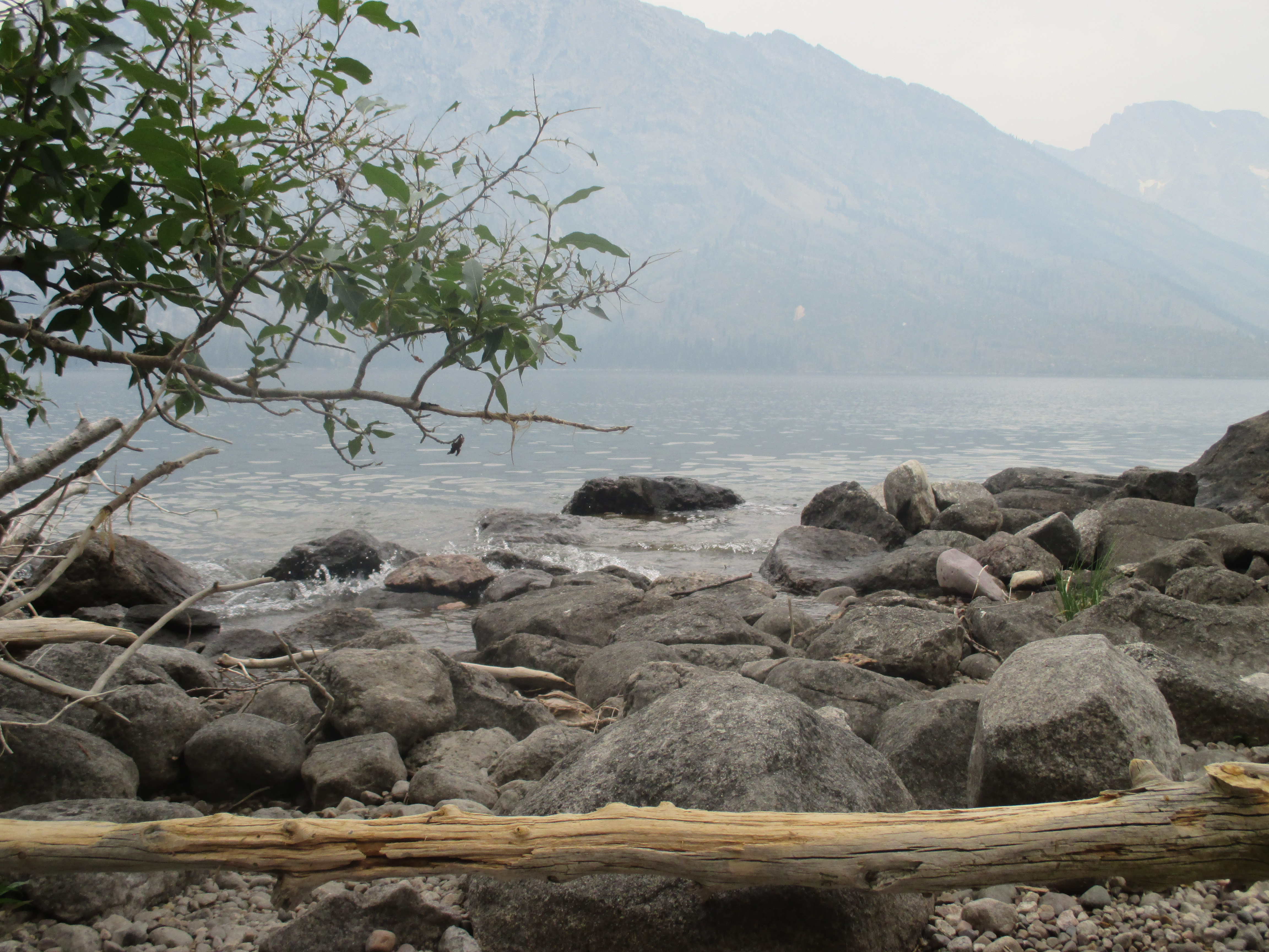
I started hiking with the best intentions and even stopped once to compose a brilliant masterpiece. At this stop, I found a new chair to get acquainted with. This one was an ergonomically shaped tree trunk with a smooth stone placed right below it. From this seat, I could enjoy the view of the mountains and hear the gentle splash of water as the waves came and went.
When I finished the writing that I wanted to do at that point, I got up and kept walking. I decided to follow the path I was on as it curved around Jenny Lake. The route looked fun to me, and I thought it would be good to make this a long walk so that I would have more time to write.
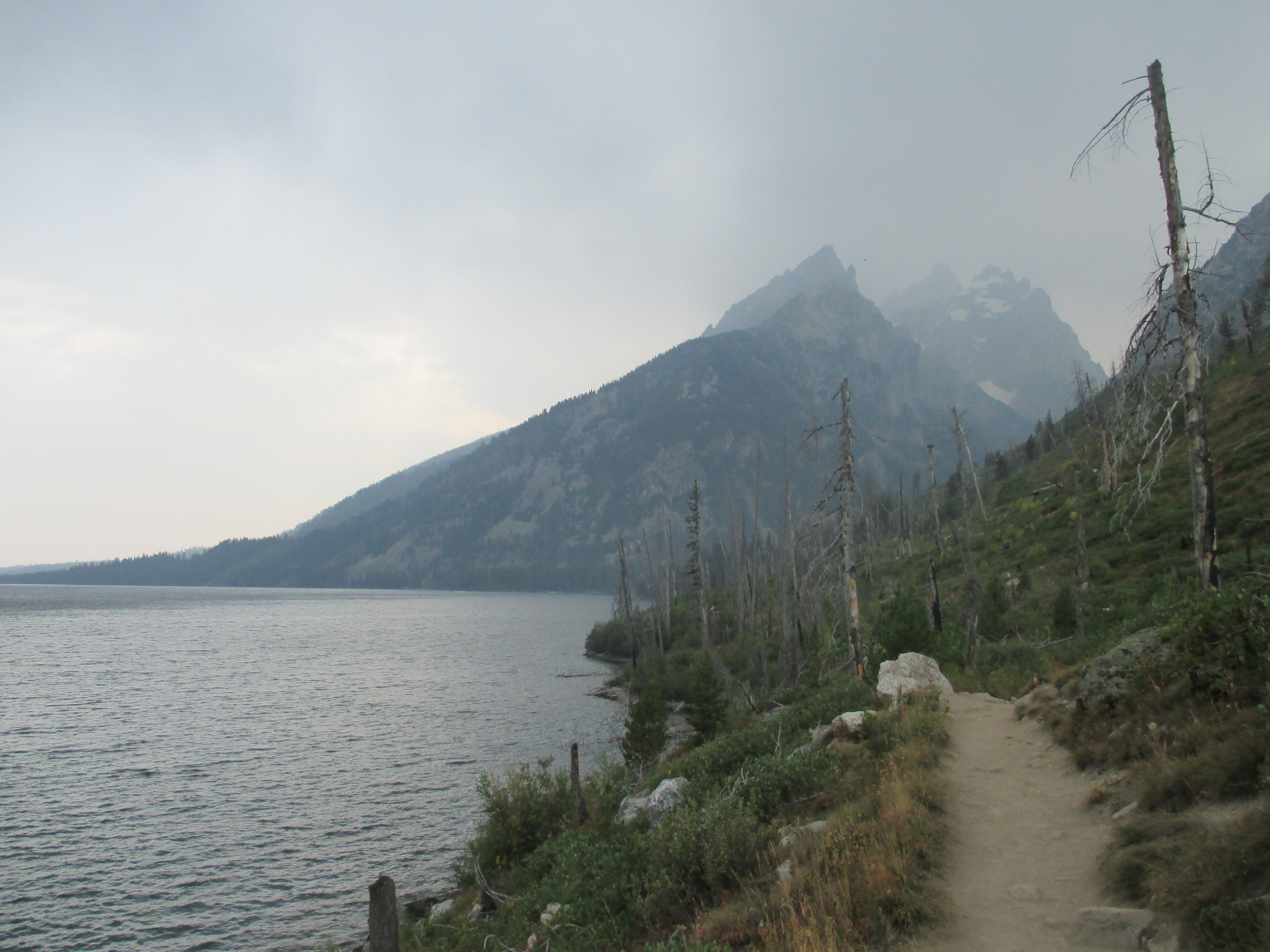
I almost took a second writing break, but then I decided I wasn’t ready yet – I wanted to get further down the trail. I kept telling myself I wanted to walk just a little bit further until I reached the halfway point of the loop I had chosen to walk. At that point, I realized that I was more than five miles into the walk and I still had at least five miles to go – and the smokey haze in the sky had been joined by clouds that looked about ready to burst.
So much for writing. I just kept walking and hoped that the rain would hold off till I made it back to my car. After two light showers, the rain took pity on me and went away. The clouds even dissipated as I neared the end of my hike and left the sky a little clearer than it was before.
The hike turned out to be a lot of fun – way more fun than I expected. I took more than a hundred pictures and walked eleven miles. It’s inspired me to do more hiking. I think I may wake up early and try a longer path tomorrow.


 Eventually, the air got too cold for me and we went back to the car, ready to begin the descent. And then we changed our minds and got back out. There was one store at the top, called the Summit House, and we wanted to check it out. We found that most things were expensive (of course), but we were hungry. We passed up the seven dollar chicken sandwiches for one dollar “world famous” donuts and three dollar cappuccinos.