Tag Archives: car camping
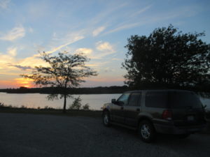
Ford Expedition, air mattress, sleeping bag.
September 30th – Chicago
On a trip full of incredible experiences, Chicago scores one of the top spots. I can’t measure it against my favorite days of hiking and camping because the activities are so different, but it’s certainly up there with them. I found a lot of reasons to like Chicago. There was the gorgeous skyline, the wonderful pizza, and the people (most of whom were friendly). I really don’t know what else I could ask for!
Before reentering Chicago, I stopped at a McDonald’s to borrow their Wifi. I haven’t yet become callous enough to use a restaurant’s services without purchasing something, so I went to the counter to order a strawberry banana smoothie. There, I met Alonzo – the happiest McDonald’s worker I’ve ever seen. He greeted me and asked me how my day was going. Before I could answer, he told me that his day was “pretty dope.” After taking my order, he asked about me again, so I told him about my trip. That excited him even more and he said he wanted to do the same thing someday. I encouraged him to do it.
When my smoothie came out, I sat down and got to work on the serious task I had come to do; replenish my depleted supply of audiobooks. Two caught my eye; The Picture of Dorian Gray by Oscar Wilde and The Republic by Plato. I’m looking forward to getting started on them!
With my books downloaded, I got back in my car and drove into the city. I intended to start my walking tour of Chicago at the Ernest Hemingway Birthplace and Museum, so when “Hemingway House” showed up as a search result on Google Maps, I selected it. I thought that if Hemingway was born and lived at a particular location, it would be called his house. I learned my mistake when I walked up to the large glass doors of the Hemingway House and saw the smartly dressed desk clerk. Apparently, the Hemingway House is an upscale apartment complex that has nothing to do with the famous author, except for the use of his name. The clerk even looked up from his desk and gave me a look that said, “How dare a lowly commoner stand outside my door – wearing jeans, no less!”
I did make it to the Ernest Hemingway Birthplace and Museum on the next try. There were two buildings to tour, and I only had time to go through one, since I also wanted to walk and get dinner in downtown Chicago. I settled on the museum because I didn’t know very much about Hemingway. Despite my interest in literature, I have not read any of his works yet.
The museum volunteer was a little too friendly for my taste. She would have told me stories at the front desk all day if I had let her. I sat through one story, in which she took ten minutes to narrate the tragic history of a BBC documentary of Hemingway’s life and how it happened that this museum owned the only remaining public copy of the film. At the end of this story, I extricated myself and headed into the museum itself.
Inside, I found lots of pictures and plaques along with several artifacts from the author’s life. learned that Ernest Hemingway was born in 1899 in Oak Park (a small city that sits on Chicago’s western border) and went to school like most boys and girls do. After finishing high school, he became a news reporter and kept that job until he joined the military in 1916. He spent two years driving ambulances near the front lines before a blast of shrapnel severely injured him and sent him to a hospital back in the United States. Near the end of his time in the military, he met and fell in love with a nurse named Agnes. When his injury sent him home, he received a polite letter from Agnes, in which she told him she did not share his romantic feelings. Her rejection devastated him and many historians attribute the failure of his four ensuing marriages to that early heartbreak. He began his career as an author in 1926 and wrote six novels (among other works) before his death in 1961.
I left as the museum closed, and my new friend at the front desk offered me a box of garlic knots, saying that she was too full to eat them. I politely declined and continued on my way – toward my own dinner, and the Magnificent Mile.
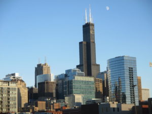
The Magnificent Mile is a famous stretch of Michigan Avenue in downtown Chicago. It’s full of people, cars, restaurants, shopfronts, and huge buildings. I managed to find free parking, but I did have to walk a mile to get back to Michigan Avenue. The walk gave me the chance to see the skyline and to notice the moon as well.
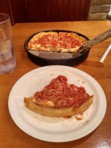
I made my way in a leisurely fashion to Lou Malnati’s Pizzeria. Two people I worked with in California have visited Chicago many times and both recommended this place. It was certainly popular when I got there. I waited an hour wait to sit down, but when the deep dish Chicago Classic Pizza came to my table, I knew the wait had been worth it. Sausage, cheese, sauce, and bread never tasted so good!
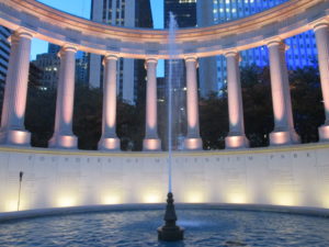
After dinner, I walked back up the Magnificent Mile and detoured through some of Millenium Park. The sky was beginning to darken, so most of my pictures didn’t turn out very well. The walk was beautiful though, and I found a plaque that explained why. The many pavilions, fountains, gardens, and monuments that constitute Millenium Park were finished in 2004, and cost four hundred seventy-five million dollars to complete! I am just one of the twenty-five million persons who are estimated to visit the park this year.
Despite the good time I was having, I did not want to be out too long past dark since I’d have to walk through a few of the less populated parts of the city on my way back to my parking spot. So I called an end to the evening, had a safe walk to my car, and ended my night back at the Illinois State Beach.
I enjoyed every bit of Chicago that I explored, but I know there’s a lot more to see. Maybe that’s why I liked it so much – I just can’t wait to go back!
September 29th – Beached
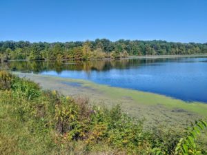
In daylight, I found that I was parked at a place called Hawthorne Park. A thicket of trees surrounded the lot I had stopped in, and just past those trees, I discovered a beautiful wetland reserve. Since I was already parked there, I decided to start my morning off with a brisk walk around the water.
With the invigoration that comes from spending time in nature, I began my drive to Chicago. I made two miles of progress before my stomach reminded me that invigoration is a wonderful thing, but food is much more practical, and I hadn’t eaten yet. I stopped at a Subway and walked in to buy I sandwich, as I usually do. After I parked, I realized that this Subway had a drive-through window! I continued in my old-fashioned ways though and walked in, bought my sandwich, and got back on the road.
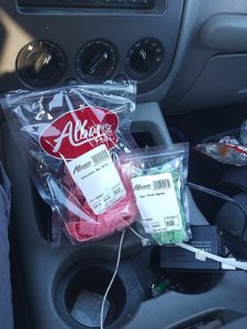
A hundred fifty miles later, my attention was irresistibly drawn to signs on the Interstate that advertised for the, “Albanese Candy Factory.” It wasn’t the name that attracted me though, it was the pictures of giant gummy bears. I followed the signs and found the factory a few miles off the Interstate. Several windows in the back of the store allowed me to see into the candy factory, but cameras were prohibited.
 There was a wide variety of gummy candies in the store. I managed to restrain myself to purchasing two small bags.
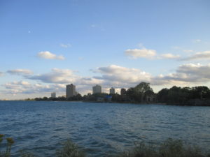
After driving another seventy-five miles, I made it to Chicago. That was the extent of my planning for the day – just make it into the city. So I pulled off the road and enjoyed this beautiful view of Lake Michigan and the Chicago skyline as I worked out a place to stay.
I couldn’t find a free campsite anywhere near Chicago, so I prepared myself to pay for a site. I settled upon the Illinois State Beach campground. I had to drive another fifty miles to get there, but I it was a great campsite and I did not really want to stay close Chicago itself.
The day ended with pushups, a shower, and a chance to sit down and read more of A Walk Across America.
Travel Details
Starting Point: Terra Haute, Indiana
Destination: Illinois State Beach, Illinois
General Route: North on State Highway 41 and Interstate 65
Miles Driven: 275
Additional Note: 200 push-ups completed at Illinois State Beach, now 9 states done!
Additional additional note: I will include the above section when I have long days of driving so that it will be easier to see where I have been and how I’ve gotten there!
September 28th – Another Farewell
My car has clean oil! Wonderful, fresh, new oil!
I intended to get an oil change done in Colorado Springs, but that didn’t work out (thanks to a sticky drain plug), so I decided to change it myself somewhere along the way. When I mentioned my problem to Scott yesterday, he offered to let me use his tools and to help me as well.
I went to the local hardware store (fittingly named Rural King) and found the supplies I needed; an oil filter and seven quarts of oil. I was going to change the oil myself, but Scott kindly jumped in to help out. I ended up standing around feeling lazy, so I made myself the tool fetcher, moral supporter, and dog watcher. Dog watching proved to be an entertaining job, as Lola spent the entire time racing in tight circles around the yard chasing her ever-elusive tail.
After the successful oil change, I did a few things around the house and picked Aden up from the mechanic’s shop where she dropped her car off to get tuned up. On the way back from the shop, we made an important stop at the Bank. But this was no normal bank, where money is the only thing that is exchanged. This was a Donut Bank – where money is indeed exchanged, but the trade results in the receipt of a donut! The old-fashioned donut I had was wonderful, and Aden enjoyed her cake donut as well.
The rest of the afternoon passed in small tasks I needed to take care of and another trip to the mechanic, where Aden picked up her rejuvenated car. I planned to start driving toward Chicago before the day was over, but I wanted to see Dorothy and her husband, Bob, again before I left. I’d only seen her for a few hours at the family gatherings we’d had on the previous two days. So I arranged to visit with them at their house and then go to dinner with them. At their house, I asked lots of questions about members of my family that I never got to meet. When we went to dinner, we were joined by Laura, Scott, and Aden. We ate at Cheddar’s – a sit-down restaurant that advertises its fresh, “made-from-scratch” food. We all agreed that their onion rings were wonderful, and I enjoyed a country fried steak. Before I knew it, dinner was over and it was time to say goodbye. I will miss Evansville and this vivacious part of my family!
Finally, I left Evansville behind and headed for a rest stop I’d found on the I-70 just west of Terra Haute. I’ve been having problems locating campsites after sunset, so I decided to try a rest stop since there would really be no way to miss it while driving along the Interstate.
I did find the rest stop easily. One point for team Matthew! However, I found a problem as well. There was a nasty sign that said, “NO OVERNIGHT PARKING.” Bummer. That meant I was back to the old “drive around in circles” thing. It turned out well enough this time. I found a what appeared to be a back-woodsy kind of park. I didn’t see any of those nasty signs prohibiting overnight parking in the area, so I pulled into the parking lot and settled in for the night.
September 22nd – Milford Lake
I woke up to find that, in daylight, there was a beautiful view outside my windows. I also found that the sun, which highlights the landscape so well, heats up the air also. Especially the air in a confined space, like my car. So I got out of heat box and took a short walk, then returned to my car, started up the air conditioner, and drove toward my next destination.
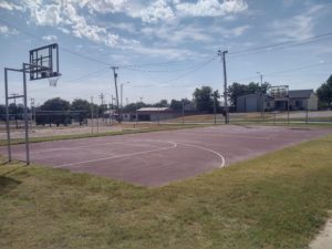
That destination wasn’t very far away. It was a basketball court in Hill City, Kansas that I’d found online last week. When I began my trip, I intended to do basketball drills twice a week as I had done with my brother during the summer, but it has been more difficult than I anticipated to find courts. Well, here was one in the middle of Kansas, and I was going to use it. Even though the sun was hot, and even though the court was on a street corner so that every driver probably stared at me as they drove past and said, “Doesn’t he look funny, doing all those weird jumpy thingies!”
I think I did look funny doing my jumpy thingies, but that is okay. I finished up my drills and got ready to get back on the road. Before leaving, I pulled some food out of my stash. I used cajun deli turkey, Muenster cheese, and tortillas to make a delicious wrap.
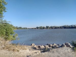
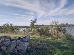
One hundred fifteen miles later, I was in Junction City, driving around Milford lake in search of a shady spot to park and camp. It took me two loops around the campsite to find the only tree in the area that provided decent shade. It wouldn’t cover my car, but it did cover a grassy spot so that I could inflate my balloon chair underneath it and spend the rest of the afternoon reading comfortably.
And that’s what I did. I continued reading A Walk Across America by Peter Jenkins. This book is an autobiographical narrative of Peter Jenkin’s trip across the country, a little bit like the blog that I am writing. There are a few differences though. Peter didn’t have a cozy car to hide in, and he didn’t spend afternoons reading under shade trees. He started his walk in 1973, in upstate New York and traveled about thirty miles a day in his quest to cross the continent. It has been fun to read this account of another traveler, even though we’ve had different paths and approaches.
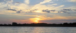
I stayed happily in my spot until the sun met the horizon. Then I got up, took a few pictures, and put my balloon chair back into my car. I finished the evening with a call to my family, then climbed into bed.
September 21st – Monument Rocks
My nine-day stop at The Mansion is over and I am back on the road. It was a fitting day to start driving again; today marks the beginning of my second month on the road!
So I’m back on my own. Today, I spent most of my time behind the wheel. I drove about four hundred miles through Eastern Colorado and Western Kansas. I took state highways and found that, once I could no longer see the Rocky Mountains, the scenery of both states blended seamlessly together. The landscape was dominated by empty fields and rolls of hay from the fall harvest. Farmhouses, junkyards, old cars, and people popped into the picture from time to time. Other times everything would disappear, leaving the land empty except for rocks and scraggly bushes.
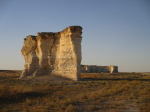
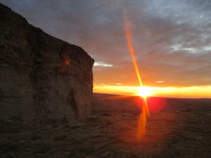
I took a detour from my route east on Kansas State Highway 40 to drive south and see the “Monument Rocks.” I found them without any trouble. They are the only things that stick out against the horizon in the flat expanse of the Kansas plains. I got out to take pictures and noticed the wind and heat that my car had protected me from all day. It was about ninety degrees and humid, with a warm wind blowing over the plains.
The sun began to set as I left the rocks. It took me another hour and a half to reach the Sheridan State Fishing Preserve where I planned to camp for the night. So again I pulled into a campsite in the dark – but this time it worked out well. There were no other people around, so I used my high beams to find a spot. As I pulled in, I heard the wind still going strong, gusting through the leaves of nearby trees.
I opened the door and was greeted by the warm air and my new least favorite sound – the buzzing of flies. There were just a few flying around the area, but their presence meant that I couldn’t open up the windows to let in fresh and hopefully cool air while I slept. Oh well. I prepared for bed while managing to keep the flies out of the car, then settled in to sleep through the humid eighty-degree night.
September 10th – Don’t Fall!
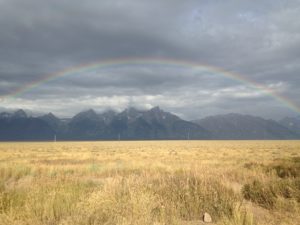
This morning I let myself sleep in after the long day of hiking. When I finally got out of my car, I was treated to a rainbow. It spanned the whole sky in front of me, enclosing the Teton mountain range. Sadly, I did not see any leprechauns prowling around, so I figured that the gold at the base of this rainbow must have already been taken.
After admiring the rainbow, I started driving. Today I was in search of the Internet and a quiet place to sit. I wanted to update my blog and find a place to stay on my way to Colorado Springs.
On my way south, I drove through Jackson, Wyoming, and found myself back in the middle of a familiar phenomenon – a traffic jam. This was a bustling tourist town and I must have hit it at rush hour. There were several coffee shops I could have stopped there, but I wanted to get further along my way than that, so I kept driving. After Jackson, I felt like I drove forever without seeing another car. The few tiny towns I passed through had populations around two hundred people. My phone had no cell service for over a hundred miles.
Eventually, I happened to look down at my gas gauge. Oops. I had an empty tank. I’d driven 440 miles so far and that’s at least 50 more than I have been used to letting it go. There was still nothing within sight and no data connection on my phone. No way to go but forward! I’m not generally a nervous person, but I started to become one at this moment. I decided that was silly though. Being nervous could increase my blood pressure, but not refill the gas tank. I was driving, and that was the only helpful thing I could do.
I got to 460 miles. Those nerves came back and were very unhelpful again. Finally, I entered the limits of Rock Springs, Wyoming. This was a real city, one with people and stores and traffic. I looked for the closest gas station found an Exxon to fuel up at. As I waited to turn left into the gas station, I wondered if my tank would last through the light. It did, and the tank only took twenty-five gallons, which meant that there had been three gallons left. I could have gone fifty more miles!
After getting gas, I went to a McDonalds – again. It’s becoming a familiar place for me on this trip. I did some writing there, though the slow internet made uploading the two posts I finished take forever. When it was time to move on, I found a campsite that was only about twenty minutes away.
The directions to the campsite took me up to my new favorite road. It carried me along the ridges of the canyon formations that surround Rock Springs. I passed the pull-off for the campsite I was looking for and kept exploring the road.
I drove to one end of the road and found a cool spire that projected out of the formation. There was a road that led out to it, so I figured I was obviously supposed to drive out on it. The drive out went well. Then I got out of the car and realized how high this ledge was off the ground, and what a relatively narrow space I had to turn around. It was probably twenty-five feet wide, and that would be lots of room – if my car wasn’t eighteen feet long. I’d have to make a really tight turn and be careful not to drive too far forward. I didn’t want to go plummeting to the valley floor. On the bright side (the very bright side), the sunset was gorgeous from that spot.
I could back up along the way that I had come, but I was not that confident that I could back up in a straight line for a hundred yards. I started to understand what cats feel like when they’ve climbed up a tree and can’t muster the nerve to come back down.
Turning around seemed to be the safest bet. I started the turn and went forward about a foot. Then I turned off the engine and walked around my car to see exactly how far I could drive safely in each direction. It looked like I had about three feet on each side. Past that, the ground sloped down steeply and disappeared. So I got back in my car and backed up two feet. Then went forward two feet. Again, I got out, checked, and got back in. Whew. Back up, go forward. Last time now, back up, and there we go… forward for the last time, leaving the precarious ledge behind.
That last episode had been enough adventure for one night, so I returned to the campsite I found and parked – leaving plenty of room between me and the edge of the canyon. I got out to stretch and play my guitar, then climbed into my cozy bed in the back and went to sleep.
September 9th – Buck Mountain
THE GRAND HIKING PLAN
– Bring a lot of food and water
– Take some pictures
– Listen to an audiobook
– Walk a long, long way
This was my strategy as I woke up and drove back to the Teton National Forest this morning. I suppose it would be more accurate to call it an outline. A very rough outline. Looking back, it probably could have been improved if I had figured out specific details (especially about where I was walking). But if I took the time to work all of that out, maybe I would have chickened out and not gone on the hike. And then I would have missed my favorite adventure of this trip so far. Here’s the story of how it turned out.
I did bring a lot of food. Two ham and cheese bagelwiches, two cliff bars, two servings of protein powder, one snack-sized bag of trail mix, half a bag of baby carrots, and five bottles of water. Yes, I put all of that in my backpack. It was heavy and made me sweat disgustingly (although that may have happened even if I hadn’t been wearing the backpack). It was well worth it all though when I was able to satisfy my hunger and thirst with the treasures I carried.
I took some pictures. Quite a few pictures – over a hundred, for the second day in a row. Yesterday it was easy to sort through the photos. Some were interesting and most weren’t. The interesting ones went into my post for the day and the others will be forgotten. Today it’s harder. The mountains, trees, animals, and clouds were incredible from every angle. A hundred pictures are too many to post though, so I picked my favorite-favorites and had to leave the rest (my just-normal-favorites) behind on my SD card.
I listened to an audiobook. I borrowed A Connecticut Yankee in King Arthur’s Court by Mark Twain from the online library I use. I started it on my drive to the trailhead and finished it about three-quarters of the way through my hike. Eventually, I’ll write my thoughts about it on the “Books” page that is linked on the sidebar of this site. There’s already more than enough to write about today without adding in a book summary.
I did walk a long, long way – and I did a lot more climbing than I expected to. Last night, I decided to start my hike at the Taggart Lake Trailhead and see how far I could go. It looked like the trail went in a big circle around the Teton Range. I thought it would be cool to see the mountains from the every angle, and that’s what I expected to do. It turned out that the trail goes over the top of the mountains, not around, and that the full loop is at least a forty-mile trip. By the time I figured that out, I was already over six miles into the hike and I really didn’t want to turn back. I decided to keep going until prudence absolutely insisted that I turn back. Before I talk about that though, I should probably go back to the beginning.
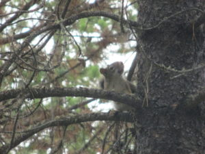
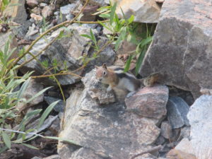
The hike started out well. After walking for a solitary forty-five minutes, I met a friendly squirrel – at least I think he was a squirrel. Maybe Sam, the official wildlife expert on this site, can double check that for me. Anyway, the squirrel (as I will call him for now) seemed quite excited to see me with my camera and he posed perfectly for a picture. I think he was embarrassed after I took it though because he started to hide his face behind the branch he was sitting on.
The path was well kept for the most part. There were a few places though where I had to push my way through fresh undergrowth that hadn’t yet been trimmed back.
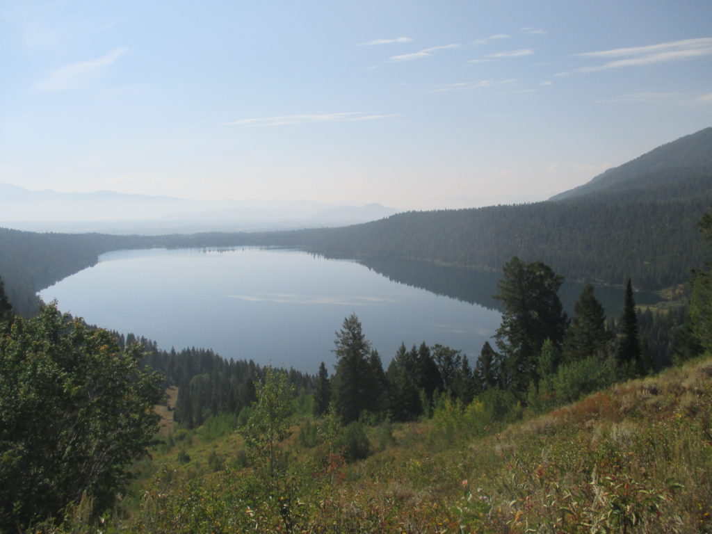
The grass and vegetation stayed with me for the first three miles. Then I was moved onto a hardpacked dirt path which led in a long, gradual slope to this view of Phelps Lake. From here the trail went into downhill switchbacks. I enjoyed the easy walk down and I hoped I wouldn’t have to walk back up.
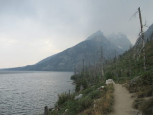
The hardpacked dirt continued and I started to ascend again. I got a great side view of the mountain range.
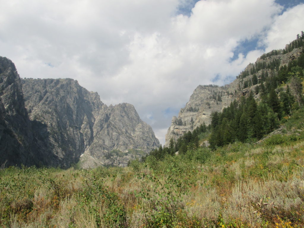
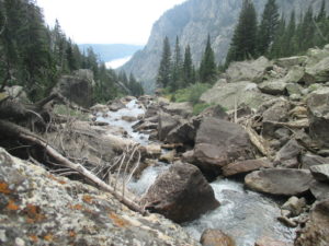
At this point, I started to figure out that I was headed right toward the middle of the mountains, not the back. The trail began to climb more steeply and stones appeared in the pathway, sometimes as steps and sometimes only managing to get in the way. A series of tiny waterfalls ran roughly parallel to the trail and sometimes came close enough for me to walk onto them.
Eventually the I reached a clear pool of water that fed the waterfalls. Once I passed that, I entered a dense forest that ushered me to the base of what turned out to be a four-mile path of endless switchbacks. This was by far the worst part of the hike. So far, I had gone about ten miles in a little over three hours. This four-mile stretch took another three hours all by itself.
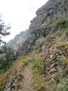
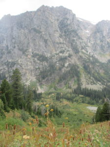
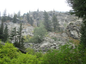
In the picture on the left, you can see the narrow path that led upward. If you look carefully at the picture on the right, you’ll see the flowers and grass in the foreground with everything else in the background. The only thing in between was a steep slope with some shrubbery growing on it. I didn’t think that falling off the side of the path would be very fun so I did my best to avoid it.

